4WD Treks Close to Melbourne (4WDCTM) showcases twenty 4WD offroad trips, all of which start within a two hours drive of Melbourne.

4WDCTM’s trips vary in difficult from easy, accessible in all weathers with a softroader, to difficult…dry weather only, and you’d better be well-equipped! The book includes:
- detailed turn-by-turn route directions
- coordinates in lat/long as well as UTM so you can navigate with a GPS receiver
- numerous descriptions of what you can see and do on and around each trip
- lots of full-colour photography
- guidance on 4WD touring and offroad driving in Victoria.
The book was originally published in 2014, and re-published in 2019 after being updated by the Range Rover Club of Victoria.
Please note that the nature of offroad tracks is to constantly change, so always be independently confident of your own navigation and prepared to execute vehicle recovery.
Please Note: Due to the rolling variation of wheels and tyres from vehicle to vehicle, and especially minor changes in track route you are likely to find some route direction readings do not correspond with your vehicle’s trip meter. You will obtain the most accuracy from the notes by resetting your trip meter at each intermediate reading as by doing this any variations in distance will not be compounded over the whole trek.
It is highly recommended that the route directions be used as a guide in conjunction with the maps recommended in each trek note.
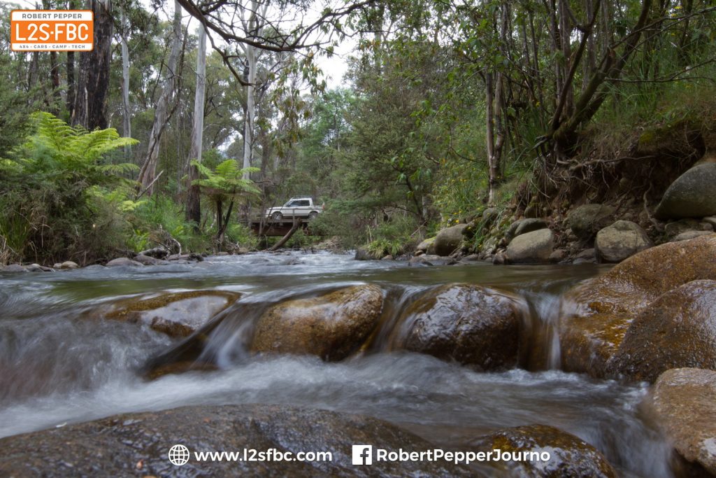
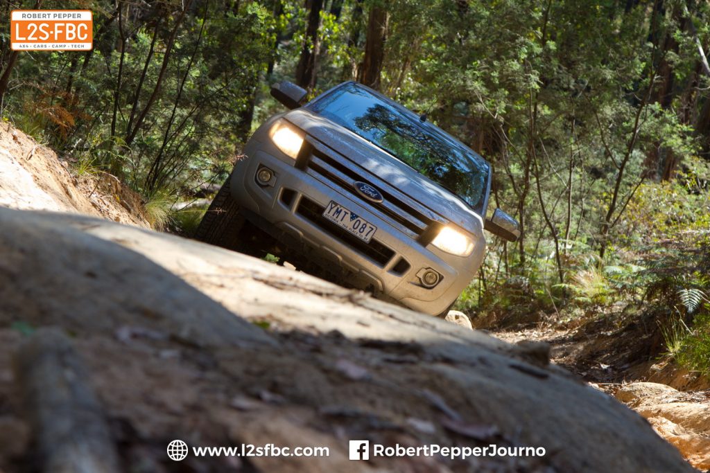
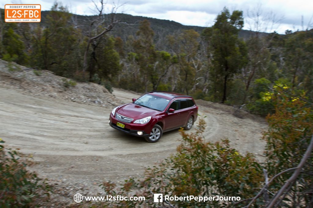
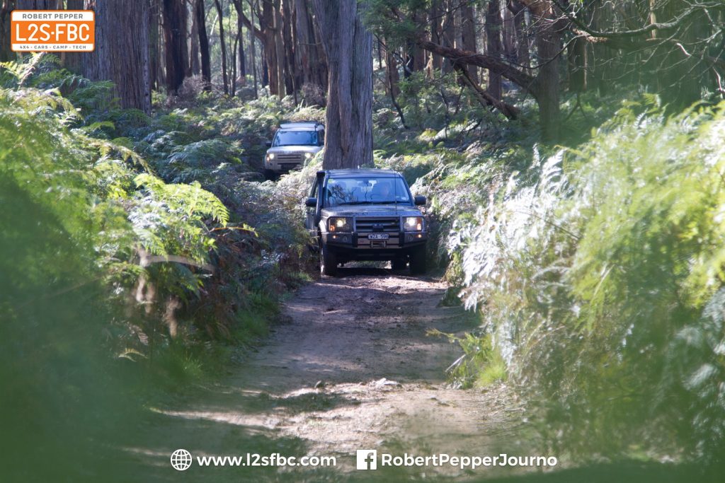
Some imagery from the book and travels:


Here’s an excerpt from the introductory section of 4WDCTM:
Firebans & Code Red Days
In the summer months there is the risk of bushfire and some days are designated as official Fire Ban days. It is your responsibility to know when Fire Bans are in force as and what restrictions are therefore in place – it is impractical for the rangers to contact all forest users. You can find out what’s happening by checking www.cfa.vic.gov.au or calling 1800 240 667, or even using the CFA’s FireReady app for Android and Apple, but if you see a fire and it is an emergency call 000 without delay.
Extreme fire risk days are known as Code Red Days, and on those days the forests are closed to the public. That is a formal closure applying to all areas, not a recommendation, and entering a forest is an offence. That means on Code Red days you cannot do any of this book’s treks.
Only start a campfire on days when the fire risk is low and follow the usual safety principles – keep it very small, locate it in a clear area, always monitor it, have plenty of water nearby and ensure it is entirely out before you leave. Covering it doesn’t necessarily put it out, but simply insulates the heat and sometimes the fires can restart later when unattended. Significant penalties apply and are enforced for breaking fire rules and Fire Ban Day codes.
Parks and Forests
The treks pass through three main types of land; parks, forest and private. The routes through private land follow public roads, the land is usually but not always cleared for farming, there’s often a fenceline, gates and No Entry signs. Private land is often, but not always shown on maps with a white background. Do not explore private land without permission as that is trespass.
State Forests are public forest areas with a variety of attractions and tracks. State Forests are there to protect flora and fauna, manage water catchments, provide sustainable timber, preserve history and provide recreation and education opportunities. An important hazard in state forests is logging trucks, particularly during the week.
There are several different types of Parks – National, State, Wilderness, Regional and Metropolitan, with other areas designated as Reserves or Conservation Reserves. For the purposes of this book they can be considered as one.
The difference between a Park and a Forest is that Parks have more emphasis on protection of flora or fauna, whereas Forests permit more human recreation such as hunting, dirtbiking and horseriding and activity such as logging. State Forests may also be used for events such as rallies, orienteering, social gathering or competitions. You may generally take dogs into state forests, and camp anywhere but preferably in designated camp spots, and no closer than 20m to any watercourse. In Parks you must camp only in designated areas, cannot take pets and other activities are restricted in line with the greater focus on environment protection. In the case of both Forests and Parks you must stay to formed tracks, take all your rubbish with you and generally respect the environment.
The Department of Sustainability and Environment (DSE) manages all Forests, and Parks Victoria manages the Parks on behalf of the DSE.
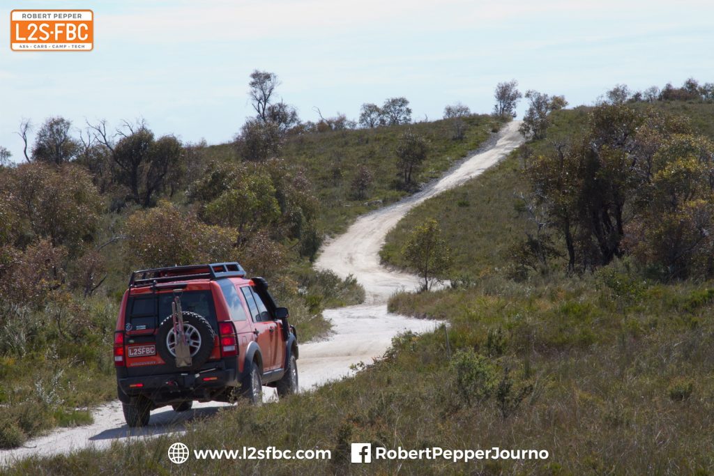
Many treks pass by private land. This is represented on the maps by a white background, and is usually but not always cleared and fenced off, often with signs. But not always. The field in the background is private land, and the Discovery is in a state forest.
Permits, Closures & MVOs
Many tracks in wetter areas are seasonally closed from approximately the Thursday after the Queen’s Birthday long weekend in June until just before the Melbourne Cup Day long weekend in early November, and we have listed these tracks in the notes. However, the exact tracks and closure times vary from year to year so you must double-check these closures before setting out. To where you can find maps and names of closed tracks check the latest surf to www.parks.vic.gov.au and search for “Seasonal Road Closures” or contact Parks Victoria on 131 963 or the DSE on 136 186. Some tracks are permanently closed to the public and are marked as MVOs, or Management Vehicle Only tracks. These may or may not appear on maps, and are visible in forests as gated tracks with MVO signposts. A useful resource for state forests is DSE’s Public Access Map available at http://www.dse.vic.gov.au/forests/public-access-map which allows you to see what tracks are available in state forests. Parks information will be added at some point in the future.
Tracks that are seasonally closed to avoid damage in the wetter winter are usually marked as such with signs like this, and closed off with a locked gate. However, the ultimate authority is the Parks Victoria and DSE websites, plus a phonecall to the ranger.
Many tracks are marked “dry weather only” to prevent damage when wet. This applies whether or not they are seasonally closed at the time.
Care of the environment
Forests are fragile and need respect. It is not difficult to enjoy yourself in the outdoors, but there are some basic rules to follow which are described in the DSE’s “4WD Touring Code” and 4WD Victoria’s “Code of Ethics”. In brief, some of them most applicable to daytrippers are – obey all track closure signs and stay on formed tracks, avoid use of tracks when wet, carry out all your rubbish, remember all native flora and fauna is protected by law, collect firewood only where specifically permitted and prepare yourself and your vehicle before setting off on a trip.
If you find a native animal that is injured then perhaps Wildlife Victoria can assist on 13 000 94535 or www.wildlifevictoria.org.au. Please also read this blog post.
Out in the bush you can certainly expect to see wild animals. Leave them along as they’re all protected. In the course of this book research we saw kangaroos, wallabies, snakes, lizards, deer, echidna, wombats, koalas and birds too numerous to count.
Other forest users
You can expect to meet other forest users at any time, particularly when you don’t want to, and never when you really need to. Some state forests are popular dirtbike locations, others are frequented by horseriders, you may well see other offroaders and sometimes hikers, mountainbikers. Drive cautiously with your lights on low beam as this makes you far more visible to others.
There may well be logging activity in many forests, but not often at weekends.
Safety
Do not go out assuming “someone will pass by” any time soon, because it is entirely possible nobody will for days or weeks. Do not rely on mobile phone coverage either, as mountains and dips easily block signals. Especially for the Medium and Difficult trips, carry recovery gear that you are confident in using, be able to navigate yourself around the locality and travel with others. While trek distances are short, fuel consumption is higher due to the slow speeds and terrain.
There’s safety in numbers. All our research for treks beyond Easy was done with other vehicles.
Reporting vandals
Unfortunately, there is a small minority of forest users who don’t care about the law or the environment they are enjoying. They may be illegally accessing areas, hunting out of season, lighting or maintaining fires on fire ban days or just generally wrecking everything they can. The authorities request that such behaviour is reported and there is a “Dob in a Hoon” form on 4WD Victoria’s website, www.fwdvictoria.org.au for that purpose.
Effect of disasters
Between 2009 and 2011 Victoria suffered major bushfires, and then significant floods and well above average rainfall. These events have in many cases damaged tracks, bridges and camping areas, causing them to be variously closed, re-routed or rebuilt. All the track work for this book was done after the 2011 flood season so it is up to date, but in many cases we have omitted apparently useful tracks or camp areas because they were not yet available. There are rebuilding efforts and so we expect the situation to improve over the years. Check our website at www.4wdmelbourne.com for updates as we find them, and please let us know of any you find. Be aware that maps may not show post-disaster tracks properly. As ever, refer to Parks Victoria for the latest information.
From 2012 onwards the authorities intend to conduct significantly more fuel reduction burning than has been the case in previous years. As this activity is highly weather-dependent a decision cannot be made on whether an area will be burned until the morning of the potential burn day. However, well before any potential burn notices will be placed in the area warning of the activity, and before a burn commences the area is thoroughly checked and roads are closed to users.